Beautiful Disaster; The San Francisquito Canyon Ride.
**The mountains between L.A. and Palmdale provide epic lessons in riding and history. This is Santa Clarita in the winter.**

I run into a ton of customers here at roll: who make frequent trips for business/family out west. Many of them ask for tips on "secret" places to ride road and mountain. Last week I had the chance to send a customer through one of the most amazing rides
in the greater Los Angeles area...but not just because of the elevation or scenery. The ride has a tragic history as well...but you'd have to know where to look to see it. San Francisquito Canyon in Valencia is a place few Angelinos have ever seen, and fewer know what happened here on March 3rd, 1928.

The L.A. rivers actually only produce enough annual water from the local mountains to provide for about a thousand people year round. Yeah..that's right..a thousand. Despite the parks, fountains, and Bentley's, Southern California is mostly desert. We get more rain on a Columbus afternoon in August than they get all year. Solution? William Mulholland. This once great hero of Angelinos brought water from the Central Valley (totally stolen) via aqueducts and pumps, dams and flood catch basins all the way in through "The Grapevine" to L.A. One such reservoir and dam was constructed in what was (up until a few years ago) still a very rural Spanish Land Grant farming community.

San Francisquito Canyon was chosen as a great site for the construction of a dam. It's a VERY narrow slot canyon, and ran a direct line into the West Side to provide much needed water. The engineers however had a problem. The dam's south side was anchored to less-than-ideal sedimentary rock...and the dam was to hold a ridiculous amount of acre-feet of water (12 billion gallons!). Well, it broke. At midnight. William Mulholland received a phone call from the dam's superintendant warning of a crack in the dam wall, and he said "it'll be fine." Hero to zero in about two seconds flat.


The mighty dam burst, and a ten story tall wall of water flushed the canyon, and it's inhabitants all the way out to the beach in Ventura. It swept every town clean from Santa Clarita to Fillmore, Piru to Valencia. No one will ever know how many perished that night, but rough estimates are at about 500. Bodies would continue to be found as far south as Mexico in the ocean for weeks after. This would be the end for the once great William M. Slowly being driven mad by the hatred cast upon him for not emptying the reservoir and saving lives, he would die all but penniless and alone.

Riding up the canyon's narrow two lane road, you are hemmed in to an ever-narrowing pair of canyon walls, and climbing steadily. the climb stays fairly reasonable as you begin to pass Pump House #2...huge 20' diameter pipes still pumping water down to the L.A. basin.
 This place was swept clean on the night of the dam break, but rebuilt later. You continue up, and right when the canyon couldn't seem to get any thinner, you see these HUGE white "marbles" about 40' around. Most ride right on by, completely unaware that those "marbles" were once part of a mighty dam. When it blew, it send concrete flying so forcefully, it turned it all back into powder-like dust. As the water re-mixed with it, it began to snowball down the canyon and roll into enormous spheres. As the water receded, the marbles slowed to s atop and have rested there for decades.
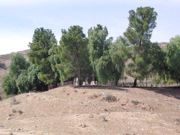
 **The Ruiz family cemetery plot, made full by the dam break.**
Just past this point, you see what could be an old road, gradually increasing in elevation, then seemingly crossing in front of you. Then it just disappears. You ride along the road, and go around this escarpment and continue on to the more climby and scenic portion of this ride. You just rolled right past the remains of the dam, riding along the road on the side where it gave out that fateful night. If you were to dismount, and take a short walk up the unmarked and often overgrown path, you would reach the top of the dam.
 Tangled re-bar and bits of rusted ornamental iron where the gangway used to be are littered everywhere. Once on the top, you can see it all laid out before you. After eighty two years, you can still make out the old water-line in the surrounding valley where the billions of gallons of liquid once sat calmy in it's comfy confines. below the dam, devastation.
As you continue on, you climb like a goat on espresso. Starting the ride at almost sea level in Piru, and now ascending to a lofty several-thousand-feet, the final pitch past the town of Green Valley is brutal. Down the back side you go, making a right onto Elizabeth Lake Rd. It's a downhill cruise for several miles until you make another right turn onto Bouquet Canyon Road.
Climbing again up and over the back side of the mountain, you have a short descent to the blue waters of Bouquet canyon reservoir. A short climb, then downhill for so many miles on this narrow two lane canyon pass, it's just unnatural.
**The Bouquet Canyon aqueduct, looking out over the Santa Clarita Valley.**
 You are so close to the stream at times you feel like if you lean the bike over any harder, you'd get wet. Finally arriving back in Valencia at the corner of Bouquet canyon and Newhall Ranch Road, you make another right and head west back into Piru. This one is epic, and the total mileage is about 90. the climbing and death-to-legs factor is much worse than you could imagine, but take a camera (or a helmet cam for the downhill) and lots of food and water.
posted by Sharpie @ August 23, 2010
0 comments
![]()
![]()

0 Comments:
Post a Comment
<< Home